We provide training on:
- Geomorphology (introduction, fluvial audit, river restoration)
- Flood risk mapping using the hydrogeomorphological method
- River Habitat Survey (certification)
- Ecological data analysis and modelling
- Modelling cause-and-effect relationships using SEM
Geomorphology
We offer the following training courses in geomorphology:
 Introduction to Geomorphology: principles of fluvial geomorphology, recognising river processes in the field, identifying geomorphological features and forms and impacts from artificial structure on morphological integrity and river processes.By the end of the course, participtants will :
- Have built an understanding of fluvial geomorphology concepts: processes, drivers of change and impacts.
- Be able to spot basic fluvial processes and forms in the field.
- Be able to spot modifications and their impacts on processes and forms.
 Geomorphological assessment: Catchment Baseline Survey. Using existing geomorphological data from the River Habitat Survey, outputs from existing predictive models (geomorphic indices maps, fine sediment delivery) and other sources to produce a summary of catchment processes, geomorphological forms, habitats, pressures and impacts.
- Geomorphological assessment: Fluvial audit. Principles and practice of fluvial audits. Historical data analysis, field survey of erosion and deposition patterns, identification of Potentially Destabilising Phenomena.
- River restoration: combining principles of fluvial geomorphology, fluvial audits methods and modelling techniques to design restoration strategies and channel structures. In this course, we will use free software for modelling flow and sediment movement under different channel design scenarios. We will be providing a list of detailed guidance and methods for common restoration techniques (e.g. riffle-pool restoration).
Flood risk mapping
 The hydrogeomorphological cartographic method is a method for mapping alluvial floodplains using geomorphological surveys and aerial photography. The methodology was developed twenty years ago in France and has since been validated using model outputs and recent flood events including in a recent case study in England. It is now one of three recommended methods by the French government to characterize flood risk. It has been widely applied in France and abroad (Africa, Asia etc) over 20,000 km of river. Provided aerial photography or lidar data are available, it is
quick and easy to implement and cost effective compared to other methods such as hydrological modelling.
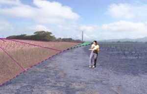
 The aim of the methodology is to delineate floodplain boundaries using morphological features (e.g. existing and old terraces) so as to identify areas likely to be flooded by increasing flood events (from frequent to rare and exceptional floods).
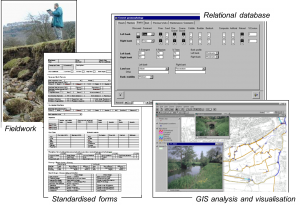
During this training course we will teach participants how to implement the methodology, from aerial photo interpretation, Lidar data processing, ground surveys and feature recognition, to GIS work and report production.
River Habitat Survey (certification)
River Habitat Survey (RHS) is a standard methodology for recording geomorphological and habitat features on 500m river reaches. The method is compliant with CEN standards on hydromorphological assessment required for the Water Framework Directive implementation. It is a standard methodology for hydromorphological monitoring in England, Wales, Spain, Portugal, Poland and other European countries.
 In England and Wales, the Environment Agency runs accreditation courses for their staff and a limited number of external participants. Accreditations are valid for 3 year after which a 1-day refresher course must be attended. There is no other organisation offering RHS accreditation.
We are recognised by the Environment Agency as competent RHS trainers and surveyors. Our team was responsible for the development of RHS in the mid 1990s as well as applications and derived methodologies (e.g. GeoRHS). We were involved in the training of RHS trainers in the Environment Agency and abroad and we accredited several hundreds surveyors and trainers in the past 20 years. To avoind confusion with the EA-run accreditation scheme, we offer a certification scheme that is an exact replica of the RHS accreditation course and includes additional material on applications of RHS and data analyses.
The course will feature field work, quizzes, discussions and a formal written and practical certification test. The test will be to the standards of the Environment Agency. We will maintain a database of certified surveyors that will be publicised free of charge on our website and on the RHS website. For information on courses, consult the RHS website events page.
Ecological data analysis and modelling
The course covers aspects of Ecological data analysis with specific Examples reference to spatial data analysis, dealing with river networks and spatial data. We will investigate various multi-variate statistical techniques such as Principal Component Analysis, Correspondence Analysis, Multiple regression analysis and demonstrate how they can be used to develop ecological indices and produce ecological models. The course will also cover the analysis of spatial data using geostatistical techniques and will introduce participants to kriging methods in R.
Modelling cause and effect relationships using SEM
 This course was delivered to a wide range of participants from the Environment Agency, the Scottish Environment Protection Agency and Scottish Fisheries Trust and introduces a new statistical technique for modelling cause-and-effect in environmental data. Structural Equation Modelling (SEM) is an extension of linear regression that enables the modelling of complex relationships between interrelated (and thus correlated) variables (see example). The method is simple, intuitive and requires basic statistical and modelling knowledge. It can be implemented using simple software with user-friendly graphical interfaces. Because SEM models account for direct and indirect impacts and can cope with correlated variables, it is one of the few modelling techniques that can be used to model causal relationships. The training course will introduce participants to Structural Equation Modelling Using Smart-PLS, a free software for implementing SEM. The course will go through the basics of building a conceptual model using environmental data on fish density,habitats and pressures, and testing it using real data. Participants will be introduced to all issues surrounding the use of SEM such as data requirements, model validation and evaluation, bootstrapping and more advanced issues such as moderating and mediating effects.

You must be logged in to post a comment.